Transportation
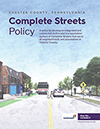 Chester County Complete Streets Policy (2021)
Chester County's Complete Streets Policy provides guidance for how streets may be planned, designed, retrofitted, and maintained to facilitate travel in a safe, convenient, and comfortable manner for all users regardless of their transportation mode. A complete street is more than adding facilities to accommodate pedestrians. Complete streets in Chester County represent an updated method of thinking about how our roadway corridors are utilized. View Policy
 Chester Valley Trail West — Feasibility Study/Master Plan (2018)
This feasibility study and master plan continues the planning work from the Chester Valley Trail (CVT) Extension to Downingtown study and recommends the primary routing for the remainder of the CVT westward through Chester County. Once complete this trail will connect Downingtown, Coatesville, Parkesburg, Atglen and points in between with the future 29-mile multi-use Enola Low Grade rail trail currently being developed in Lancaster County. This trail will ultimately be an integral part of a continuous Philadelphia to Harrisburg trail connection. The study identifies potential linkages to nearby points of interest and examines "Trail Town" precedents for using a long-distance multi-use trail to spark recreation-centered economic development.
 Phoenixville Region Multimodal Transportation Study (2018)
The Phoenixville Region Multimodal Transportation Study addresses the limitations of the current conditions for walking, biking, and transit use and focuses on ways to handle key challenges, including gaps in the network, lack of connections between urban and suburban centers, and lack of access to public transportation. The study identifies 26 total and 13 priority capital improvement projects as well as programming initiatives to increase the safety and efficiency of the transportation network regardless of age, ability, or mode of travel. Short, medium, and long term multimodal solutions serve as a starting point for the Phoenixville Region's municipalities to implement the recommendations outlined within the study. View Publication
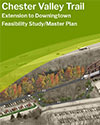 Chester Valley Trail — Extension to Downingtown Feasibility Study/Master Plan (2017)
This plan recommends the future extension of the Chester Valley Trail to adaptively reuse the currently inactive Philadelphia and Thorndale low grade rail corridor between Exton and Thorndale. This unique corridor is a hidden gem and will provide for a safe, completely grade separated trail that will attract many users due to its scenic and historic quality and proximity to regional rail stations including Exton, Whitford, Downingtown and Thorndale. Once implemented, there will be an additional 10.1 miles of trail including three new trailheads and connections to the existing Struble and East Branch Brandywine Trails in the Downingtown area. View Plan
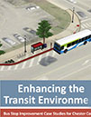 Enhancing the Transit Environment (2016)
This document illustrates how recommendations from the Multi-Modal Handbook and SEPTA's Bus Stop Design Guidelines can be applied to key locations in Chester County. The document includes case studies of conceptual improvements at nine existing bus stops intending to position these projects for potential grant funding or development/redevelopment opportunities. View Publication
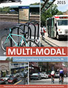 Multi-Modal Circulation Handbook for Chester County, PA (updated 2016)
A consolidated reference guide on how to incorporate all transportation modes into contemporary land development site design. View Publication
 Baltimore Pike for Everyone — Complete Street Strategies (2015)
This plan aims to transform Baltimore Pike into a "complete street" by recommending improvements to increase the safety of any user regardless of their mode of travel, age, or ability. Baltimore Pike for Everyone includes recommendations for facility improvements, a review of each municipality's ordinances, a model complete streets resolution, and additional resources for implementing complete streets. View Publication
 Chester Valley Trail Brochure (updated 2017)
The Chester Valley Trail brochure showcases one of the most popular recreation and commuter trails in the region. The brochure features a brief history of the trail, trail/contact information, and a map comprised of trailhead locations, mile markers and places of interest. The Chester Valley Trail travels 13+ miles through the heart of Chester County. When completed this 19 mile regional multi-use trail will link Exton, Great Valley, King of Prussia, and Schuylkill River Trail (to Philadelphia). Extensions of the trail west to Downingtown and Atglen are currently being studied. View Brochure
 Chester County Public Transportation Plan (2014)
A bold and ambitious plan for public transportation that will redefine the commuter preferences, facilities, and experiences for Chester County residents and workers over the next 25 years. This plan was designed to achieve the objectives of the transportation goal of the county's 2014 Strategic Plan - "Enhance access to and use of transportation systems to reduce traffic congestion."
The vision of the plan is derived directly from Landscapes2: "Provide an affordable, reliable, and accessible public transportation network to offer mobility, encourage favorable land use patterns, sustain the environment, and alleviate congestion within designated growth areas." View Project Website
 Atglen Station Concept Plan (2012)
The Atglen Station Concept Plan identifies the preferred station arrangement, parking, bicycle and pedestrian amenities for a new train station in Atglen Borough. The Plan includes station renderings, a conceptual operating plan for SEPTA service to Coatesville, Parkesburg, and Atglen, a rail improvement plan, and cost estimates. View Publication
 Central Chester County Bicycle and Pedestrian Circulation Plan (2013)
The Chester County Planning Commission worked with seven municipalities to prepare a coordinated action plan to address transportation, public health, and the environment through improvements to walking, bicycling, and public transportation. The Central Chester County Bicycle & Pedestrian Circulation Plan identified "missing links" in the transportation systems plus cost estimates and priorities for implementation. The plan also made regulatory recommendations for local ordinances and official maps. View Publication
 Travel Time Surveys, 2000-2009
Presents a summary of travel time surveys conducted on major roadways in Chester County over the last decade. The data sheet reports county-wide results, specific trends, and identifies major factors affecting travel speeds in Chester County. Noteworthy from the data sheet, county-wide travel speeds decreased 3.5 miles per hour between 2000 and 2009 based on the seven routes surveyed. View Publication
 Chester County Ride Guide (updated 2017)
The Chester County Planning Commission in partnership with Chester County Human Services Department, Chester County Department of Community Development, and county transit agencies created a Ride Guide showcasing Chester County's transit system. The Ride Guide serves as a one-stop resource to inform and direct transit users to the appropriate transit options that address their particular transportation needs. We encourage anyone who is an existing or potential transit user within Chester County to explore what the Ride Guide has to offer. View Website
Technical Memorandums
As the County's long-range transportation plan develops, technical memorandums will be published and made available for public review. Different modes of travel will be addressed with background information, analyses, discussion of issues, and recommendations.

